
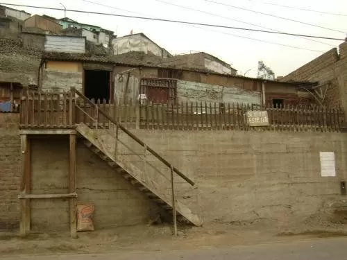
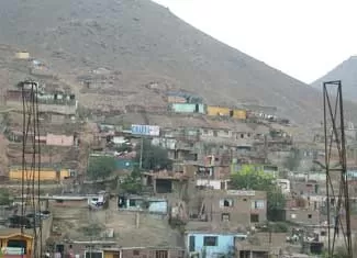
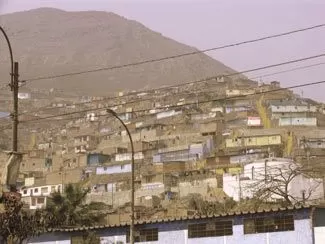
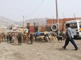
The district of Carabayllo isn't the typical tourist destination. Officially created by Don José de San Martin shortly after independence the district is today one of the poorest in Lima. Only around 35% of the district are urbanized, mainly with unpleasant simple housing in shantytowns and slums. Nevertheless even this district is worth a visit. Legacies from a turbulent and interesting pre-Hispanic past can be seen in many parts of Carabayllo.
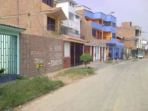
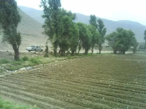
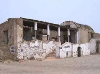
The old town of San Pedro de Carabayllo, where most houses are built out of Adobe bricks, still maintain their typical old rural town character. Along the Valley of the Chillon River many important archaeological findings were made but they are unfortunately in a quite deteriorated condition. Going to Carabayllo probably isn't your first choice, but a visit will give you a completely different experience of the beaten tourist tracks.
Facts & Figures about Carabayllo
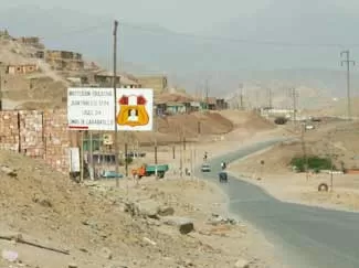
The district of Carabayllo was created by Don José de San Martin shortly after Peru's independence in 1821. It belongs politically to the Province of Lima and is located in the north of the metropolitan in the Valley of Chillon River. The district has an area of 346.88km², being the largest district of the Lima / Callao Metropolitan. Carabayllo is connected to the city of Lima and neighbouring district through the Av. Túpac Amaru and the North Pan-American-Highway.


The district of Carabayllo is limited to the north by the district of Santa Rosa de Quives (Canta province), to the south-east by the district of San Juan de Lurigancho, to the south by the district of Comas, to the west by the district of Puente Piedra and to the north-west by the district of Ancón.
The original size of Carabayllo was much bigger but it was splitted-up over the time. It original included parts now belonging to the districts of Ancón, Comas, Independencia, Los Olivos, Puente Piedra, San Martin de Porras and Santa Rosa.
Brief History of Carabayllo
The history of Carabayllo dates back to approximately 8000 to 5000 BC, when the first fishermen and peasants settled in the coastal area of Lima and in the Valley of the Chillon River. In places today known as "Oquendo", "Chivateros" or "Ancón" many findings of these first inhabitants were made. Already since 3500 BC different cultures built ceremonial and administrative center's, like "El Paraiso", "Chocas" and "Huacoy". The region developed through new techniques in agriculture, irrigation, fishing, arts and crafts and pottery. The Valley was populated quickly.
In the time between the decline of the Wari Empire around 1200 AC and the formation of the Inca Empire (1438) the Andean world was politically and culturally fractionated. Different "kingdoms" and 'señorios' arose and fought against each other to consolidate their region or to expand it. The Carabayllo region came under the influence of the Chimú. The Colliques also arose and developed seven "curacazgos" (Chuquitanta, Carabayllo, Zapán, Macas, Guaraui, Guancayo and Quivi) with their center at the fort of Collique in today's Comas (that was conquered by Tupac Yupanqui). As a result the region was governed by a "Yanacuna" (a personal servant of a nobleman or of a sovereign who was not bound to the jurisdiction of the chiefs of the communities).


After Limas foundation in 1535 the conquerors started to divide the country side around the capital. The Spaniards occupied the land, forced the indigenous people to work for them and pay taxes. Therefore many natives choose to leave and settle in the high valley of the Chillon River. Soon afterwards the city of San Pedro de Carabayllo, today the largest town of the district of Carabayllo, was founded. The 'Camino Real' from Trujillo to Lima went through the new city and brought many different ethnic groups like the Guancayo, Micas, Missais and Guaraunito San Pedro to the Carabayllo region.
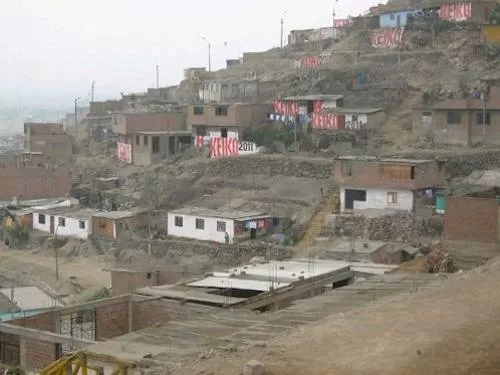
At the end of colonial times and the beginnings of the Republic many fugitive slaves lived in Carabayllo. The district was known for its great haciendas and its agricultural efforts. Similar to most districts of Lima Carabayllo had to cope with thousands of migrants from other Peruvian provinces during the 1980s attacks of Shining Path. Numerous slums and shantytown arose. Today Carabayllo is one of the poorest districts in Lima. Even with a big potential, an amazing cultural heritage, investments of big companies, many infrastructure- and social-projects the district has a long way to go.
Places to visit & attractions in Carabayllo
Carabayllo normally isn't a place where tourists would go. A lot of people will warn you to visit the district, because it's too dangerous. Nevertheless Carabayllo can look back on a rich past and a present more people should know about. If you want to go there, take a little bit more than normal precautions; leave everything (!) valuable somewhere safe and only take the absolute minimum of money with you, be friendly and open minded. Then you should be fine and have a completely different experience - off the beaten tourist tracks.


Mansion of Punchauca
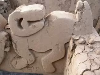
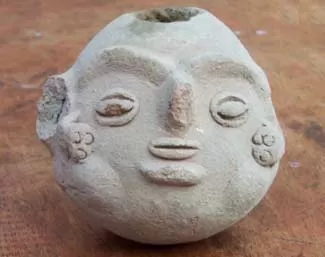
Unfortunately there is not a lot left of this once typical mansión of rural architecture. Therefore visit the nice small "Museo Regional de Arqueología, Antropología e Historia de Carabayllo" at km 25.2 (Carretera a Canta, Santiago de Punchauca) that leads you through Carabayllos past. Opening hours are Monday to Sunday 08.00 am to 05.00 pm.
San Pedro de Carabayllo
The village of San Pedro de Carabayllo, the oldest in the northern region of Lima.
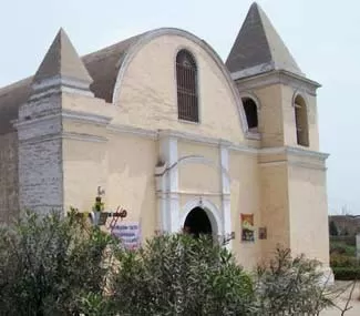
Church of San Pedro
The Church of San Pedro was built in 1575 and is therefore the oldest one of the northern Lima region and also the oldest in Peru.
Lomas de Carabayllo
The ecosystem of "Lomas de Carabayllo", known as "Bosque Seco", an unique ecosystem in the middle of the dessert with an amazing vegetation, that only can occur because of the high humidity in the cold and damp winter months on the coastal stripe; located near the slums of San Benito.
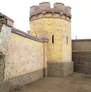
El Fortin Español
"The Spanish Fortress" Ceremonial Center of Huacoy, a pre-Hispanic temple located at km 22.5 of the Avenida Tupac Amaru to the left in the Valley of the Chillon River.
Templo El Zorro
"Temple of the Fox" - The Temple is with around 4200 years of age the oldest known observatory in the Americas (Located in the middle of the Chillon Valley officially in the district of Santa Rosa de Quives, Province of Canta, but just a few meters away from the 'border' to Carabayllo).
Other attractions
Many small natural and archaeological attractions along the Chillón River.


")


")


")


